Our expertise
We offer a geospatial consultancy service focusing upon Smart Campus - including simple maps, advanced spatial analysis, and intelligent dashboards. We also offer consultancy on AI, IoT and machine learning innovation, engaging with the latest cutting edge developments.
What we do
Consultancy
Advice and consultancy on mapping and GIS, including managing and running projects, data conversion and building GIS.
GIS
Expertise in GIS software to visualise data and create impact for projects/reports. We develop, support and manage geospatial applications.
Support
Help with existing projects, large or small, as well as any specific research and analysis need you might have.
Training
Bespoke or standard training courses run on site or in-house on a range of topics including ArcGIS, QGIS and Digimap.
Our portfolio
3D GIS & real time
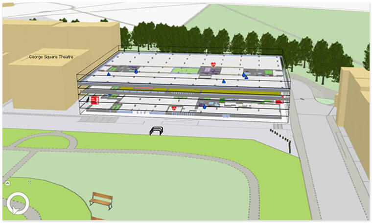
The project created a full 3D GIS model of the Main University Library at the University of Edinburgh using ArcGIS tools. Source data came from CAD drawings which were georeferenced and imported into the GIS. This data was then used to create interior spaces that could be connected by a routing network. An interactive web app was created showing point to point routing information within the building. A GeoEvent Server was set up that accepts real-time events from IoT devices in the building and displays then on the map.
Data visualisation
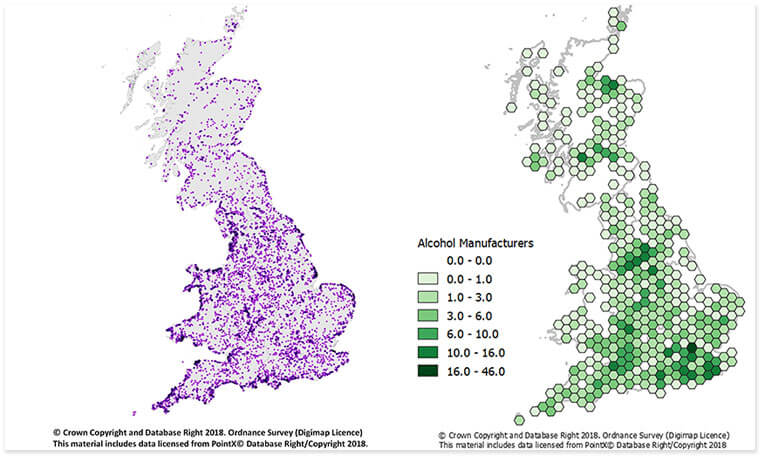
We have created a series of visualisations analysing various attributes form OpenStreetMap data and OS points of Interest. These have been published as a series of blog posts.
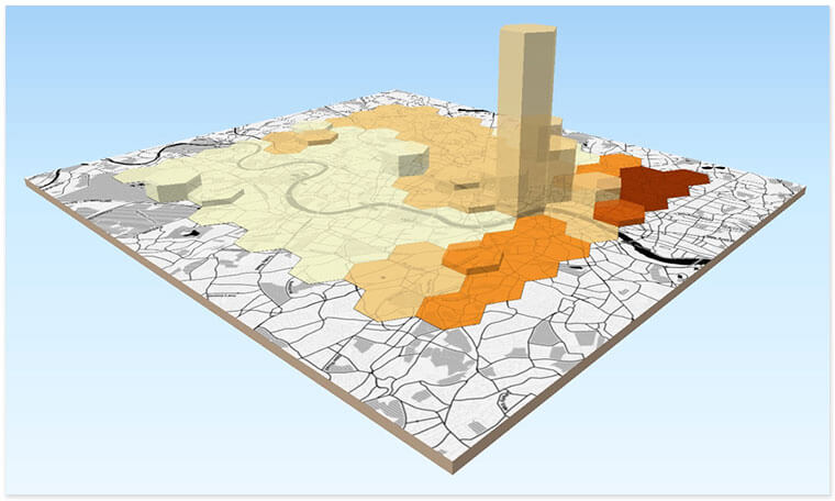
Distribution mapping
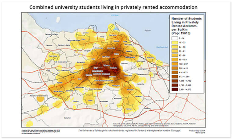
We provided support to the University of Edinburgh Strategic Planning Group with geospatial analysis /presentation of University student accommodation data over a number of years. We analysed datasets of students residences and mapped out the distribution according to various classifications. These maps have been used in official planning guidance issued by the City of Edinburgh.
Spatial analysis training
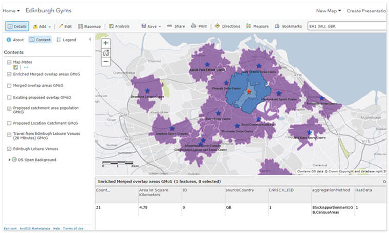
We created a bespoke two day workshop for the University of Edinburgh Business School, this introduced locational analysis for business applications. Teaching around thirty students at a time, we introduced MSc in Management students with no prior knowledge of GIS how to spatially analyse data using ArcGIS Online and Business Analyst Online. The students have gone on to use the techniques and tools learnt in their projects and dissertations.
Statistical mapping
We worked with CAHSS (The College of Arts, Humanities and Social Science) at the University of Edinburgh, to create workshops on data visualisation using QGIS.
Web app development
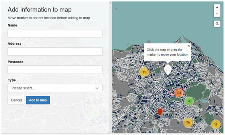
We created a simple crowdsourcing web app, hosted in the cloud, scaleable to support large numbers of users. The interface enables users to specify the style of the map, the initial zoom level, the initial location of the map, as well deciding if users can add information on the map. We developed a bespoke University of Edinburgh cartographic style using OpenStreetMap data and MapBox. This allows users to pick a mapping style that suits their purpose, corporate colours for events, topographic maps for field study sites etc. We have taken styling cues from the The University of Edinburgh GEL (Global Experience Language) and EDINAs’ own experience with cartography.